 One app for all your study abroad needs


The earliest signs of civilization in India were found on the banks of the Indus River, what is now Pakistan. Archaeologists uncovered remains of the two most prominent cities Harappa and Mohenjo Daro, which were mysteriously abandoned in 1700 B.C. This shows that India is surely a land of wonders. Here are other interesting facts about India’s geography for students for UPSC to enhance their learning about the “Golden Bird”.
Fun Facts and Important Points About India’s Geography
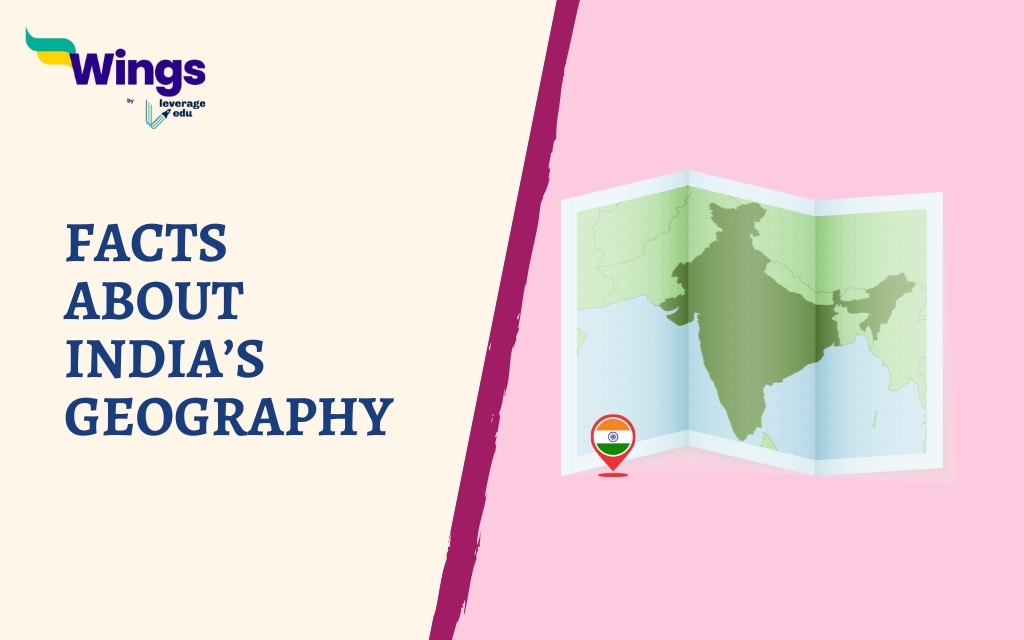
- India is a part of the Asia continent.
- The country is located in the northern and eastern hemispheres of the globe.
- The latitude and longitude of India are between 8°4′ N & 37°6′ N, from south to north and between 68°7′ E & 97°25′ E, from west to east.
- It is the seventh largest country in the world.

- It covers an area of about 2.4% of the Earth’s surface. The total land area of India is
- The country is surrounded by water on three sides. It is bordered by the Arabian Sea towards the southwest, the Bay of Bengal towards the southeast, and the Indian Ocean in the South. Therefore, most of India forms a peninsula.
- India shares its borders with nine countries including Afghanistan, Pakistan, China, Nepal, Bhutan, Bangladesh, Myanmar, Sri Lanka, and the Maldives.

- It is divided into two halves by the Tropic of Cancer (23°30′ N). It passes through the states of Gujarat, Rajasthan, Madhya Pradesh, Chhattisgarh, Jharkhand, West Bengal, Tripura, and Mizoram.
- India includes 28 states and 8 union territories.
- New Delhi is the national capital of India.
- Kanchenjunga is the highest mountain peak in India.
- Indira Point is the southernmost part of India.
- Kuttanad, located in the state of Kerala, is the lowest point of the nation. It is located at -2.2 m below the sea level.

- The Deccan Plateau is the largest plateau in India.
- The Ladakh plateau is the highest plateau in India.
- The Andaman and Nicobar is the largest island in India.
- India’s Himalaya is the world’s highest mountain range, rising in the north. This region includes numerous tallest peaks in the world, like Mount Everest and K2.

- Indo-Gangetic Plain covers much of the northern and eastern India. It took thousands of years to form from the sedimentation of the Indus, Ganges, and Brahmaputra rivers.
- The Western Ghats expand from Gujarat to Tamil Nadu and run parallel to India’s west coast for more than 1,600 kilometres. It is home to a wide range of biodiversity, wildlife sanctuaries, and national parks.
- The Eastern Ghats of India run from Odisha to Tamil Nadu and run parallel to the eastern coast.
- The Thar Desert, also known as the Great Indian Desert is the largest desert in India. It spans an area of about 200,00 square kilometres. In summer, the temperature of these regions can reach up to 50°C and below 0°C in the winter.

- India’s southern region includes a triangle-shaped Peninsular Plateau, bounded by the Eastern Ghats to the east, the Western Ghats to the west, and the Satpura Range to the north.
- The border between India and China is known as the McMohan Line.
- The Line of Actual Control (LAC) separates Indian-held lands from Chinese-held lands.
- The India-Pakistan border is known as the Radcliffe line.
- The Line of Control (LoC) is the military control line between the parts of Jammu Kashmir controlled by India and Pakistan.

- Palt Strait separates India and Sri Lanka.
- The Durand Line separates India from Afghanistan as well as Pakistan from Afghanistan.
- The India-Pakistan border is known as the Radcliffe Line.
- Indian timezone is determined by the Standard Meridian of India (82°30′ E), which goes through Mirzapur in Uttar Pradesh. Interestingly, there is a time lag of 2 hours from Gujarat to Arunachal Pradesh.

- The Ganges and Brahmaputra rivers, along with their tributaries, drain about one-third portion of India.
Hope you had fun reading these interesting geographical facts about India. If you like reading about facts, you can visit our interesting facts page to read more such blogs.
 45,000+ students trusted us with their dreams. Take the first step today!
