

 One app for all your study abroad needs


A) Radcliffe Line
B) Durand Line
C) McMahon Line
D) Red Line
Correct Answer: A) Radcliffe Line
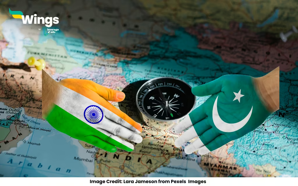
The Radcliffe Line, drawn in 1947, is the border between India and Pakistan, named after Cyril Radcliffe. Its creation during partition caused massive upheaval and remains a sensitive geopolitical boundary. Understanding its history and impact helps students navigate South Asia’s complex past and present.
What’s the Radcliffe Line?
The Radcliffe Line is the border separating India and Pakistan, drawn in 1947 during the partition of British India. Named after Sir Cyril Radcliffe, a British lawyer who led the boundary commission, it splits the two nations across Punjab in the west and Bengal in the east. The line stretches about 3,323 km, from Jammu and Kashmir to Gujarat.
This border was created in a rush, leading to disputes and conflicts that still affect India-Pakistan relations. For students, understanding the Radcliffe Line is key to grasping the partition’s impact and the geopolitical tensions that followed, making it a must-know topic.
Why Radcliffe Line and Not Others?
The other options—Durand Line, McMahon Line, and Red Line—don’t fit. The Durand Line is the border between Pakistan and Afghanistan, drawn in 1893. The McMahon Line separates India and China in the northeast. The Red Line isn’t a recognized international boundary. The Radcliffe Line is the only one that defines the India-Pakistan border.
Radcliffe’s task was tough: he had just weeks to divide a diverse region with millions of people. The line’s hasty creation caused confusion and violence, but it remains the official border. For students, knowing these distinctions clarifies India’s complex border history.
Quick Facts
- Name: Radcliffe Line, India-Pakistan border.
- Drawn By: Sir Cyril Radcliffe in 1947.
- Length: Approximately 3,323 km.
- Regions: Divides Punjab and Bengal, includes Line of Control in Kashmir.
- Impact: Sparked migration and violence during partition.
- Today: Heavily guarded, central to India-Pakistan relations.
How Was the Radcliffe Line Drawn?
In 1947, as British India split into India and Pakistan, Cyril Radcliffe was tasked with drawing the border based on religious demographics—Muslim-majority areas for Pakistan, Hindu/Sikh-majority for India. With limited time and data, he relied on outdated maps and rough population estimates, leading to messy outcomes, especially in mixed regions like Punjab and Bengal.
The process sparked massive migrations, with millions crossing the border amid violence. For students, the Radcliffe Line’s story shows how political decisions can reshape lives and nations, making it a powerful case study in history and geography.
Security Along the Radcliffe Line
The Radcliffe Line is one of the world’s most heavily guarded borders, especially in Jammu and Kashmir, where tensions run high. The Line of Control (LoC) in Kashmir, a de facto extension of the Radcliffe Line, sees frequent ceasefire violations. The Border Security Force (BSF) in India and Pakistan Rangers patrol the line, with fencing and checkpoints to curb smuggling and infiltration.
Key points like Wagah in Punjab host ceremonial border closings, drawing tourists. For students, studying the line’s security highlights how geography and politics intertwine, shaping everything from military strategy to cultural events like the Wagah ceremony.
Impact on People and Culture
The Radcliffe Line didn’t just divide land; it split communities, families, and cultures. The partition displaced 10–15 million people and caused tragic violence, with lasting scars on both sides. Punjab and Bengal, bisected by the line, saw their shared histories fragmented, though cultural ties like language and food persist.
Today, border towns like Amritsar and Lahore, just miles apart, reflect this shared yet divided heritage. For students, the Radcliffe Line offers a lens to explore how borders shape identity, migration, and memory in South Asia’s history.
Why It Matters Today
The Radcliffe Line still fuels India-Pakistan tensions, from Kashmir disputes to cross-border incidents. It’s a reminder of partition’s complex legacy and the challenges of drawing borders in diverse regions. Diplomatic talks and peace efforts often circle back to this line, making it a hot topic in international relations.
For students, the Radcliffe Line connects history to current events, showing how a 1947 decision still shapes geopolitics. It’s also a chance to reflect on unity and division, making it a compelling topic for essays or debates.
Summary
Question: What is the boundary line between India and Pakistan called?
Answer: The boundary line between India and Pakistan called Radcliffe line.
The Radcliffe Line is more than a border—it’s a symbol of partition’s challenges and enduring effects. For students, learning about it connects history, geography, and politics, offering insights into how borders shape nations and lives. It’s a topic that brings the past into sharp focus.

 60,000+ students trusted us with their dreams. Take the first step today!