

 One app for all your study abroad needs


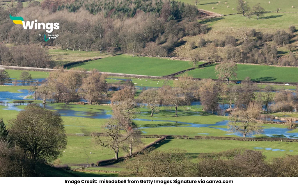
Answer: A floodplain is the flat land next to a river or stream that often gets flooded when water levels rise. It forms over time when a river overflows and spreads out, dropping layers of mud, silt, sand, and gravel. This happens especially during floods and also inside river bends where the water moves slowly. These materials build up the land sideways and upwards, making the area wider, flatter, and very fertile. So, floodplains are created by both sideways erosion and upward deposition during floods.
Complete Answer:
A floodplain is a flat, wide area next to a river that often gets covered with water during floods. It stretches from the edge of the river to the base of the surrounding land. Floodplains are made through a long process involving erosion, deposition, and flooding.
Here’s how it happens:
- Meanders and Erosion: Rivers naturally bend and curve as they flow. These curves are called meanders. On the outer side of a river bend, the water flows faster and erodes the riverbank. On the inner side of the bend, the water slows down and drops sediments like sand, silt, and gravel. This forms a point bar, building up the land sideways. This process is known as lateral accretion.
- Channel Shifting: As this happens over many years, the river slowly shifts sideways without changing the width of the meander much. This sideways movement helps to form the wide and level floodplain.
- Flooding and Vertical Accretion: When the river carries too much water, it overflows its banks. As the water spreads over the land, it slows down and drops more sediments. These settle on the land, especially near the riverbank, and build the floodplain upward. This process is called vertical accretion.
- Repeated Cycles: Over time, these processes—sideways erosion and deposition inside bends (lateral accretion) and flooding with sediment deposits (vertical accretion)—repeat again and again. This creates a large, flat, fertile area known as a floodplain.
- Other Types: Even straight rivers or braided rivers with mid-channel bars can form floodplains through similar processes.
Floodplains are rich in soil and are often used for farming. A famous example is the Kosi River floodplain in India, where the river has shifted its path by up to 730 meters in a year due to these processes.
Common Geography Doubts:

 60,000+ students trusted us with their dreams. Take the first step today!